UpstreamWX
Pre-mission weather intelligence for cavers, canyoneers, and outdoor adventurers. We pull the data, assess the hazards, and show our work. The go/no-go is your decision.
Public Beta Open the app →Free · No account required · Works in your browser
UpstreamWX installs as an app straight from your browser — no app store, no account. Open the app, then:
- iPhone & iPad (Safari) Tap Share → Add to Home Screen.
- Android & desktop (Chrome / Edge) Use the Install button in the app, or the browser menu → Install app / Add to Home Screen.
UpstreamWX is built and maintained by Southeast Expedition Medical, a small team of cavers and wilderness medicine practitioners. We built the briefing tool we wanted for our own trips: one place that pulls the official forecast, the ensemble models, and the upstream watershed together, and shows the reasoning behind the risk assessment. It is free, has no ads, and asks for no personal data.
info@upstreamwx.comRunning UpstreamWX has real costs: the servers that process the GEFS and REFS ensembles, the map and watershed data, and the time to keep the app up to date. It stays free because people who find it useful chip in. If it saved you time planning a trip, a donation helps keep it online for the next expedition.
DonateSecure checkout handled by Stripe. Give once or monthly, any amount.
The deterministic engine
Every hazard posture, confidence level, and window of concern is decided by a deterministic, documented rule engine. Identical inputs always produce an identical result. The language model used for summary generation only frames the wording of the summary. It can never compute, raise, or lower a posture.
- Four hazard exposures are scored independently on a common scale (Low, Moderate, High, Extreme).
- Each hazard applies only in the expedition phases where it is relevant (approach, technical span, egress) and per activity type. A cave technical span is treated as isolated from surface weather and shows flash flood only.
- The overall expedition posture is the maximum across all applicable hazards, and every hazard stays visible, so a high lightning posture on approach is never hidden behind a low flood posture.
- A confidence qualifier per hazard comes from GEFS ensemble agreement and cross-source consistency, including GEFS and REFS agreement on same-day windows.
Data sourcing
Providers sit behind a common interface, so the engine never depends on a specific source. If a non-mandatory source is unavailable the briefing still renders, marking that input as unavailable.
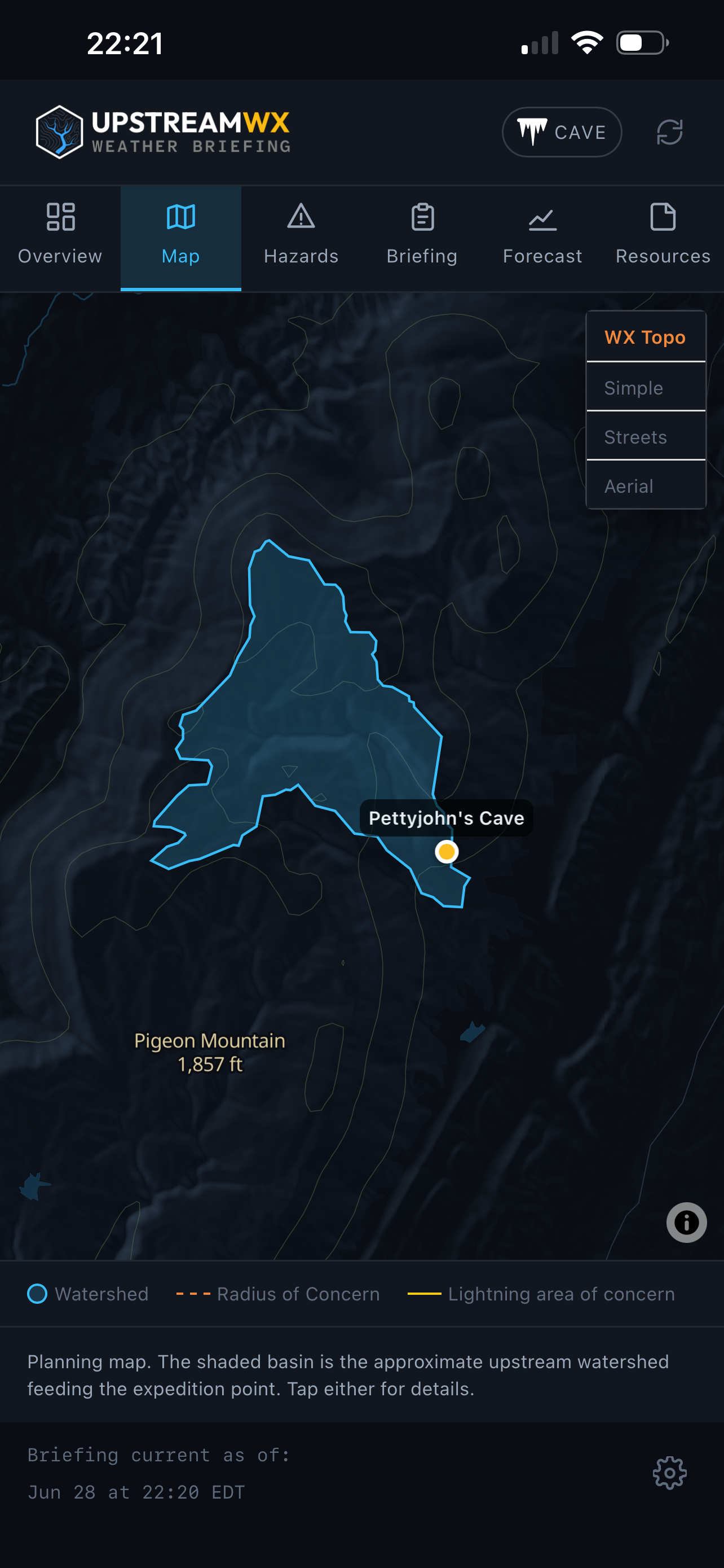
The upstream watershed
Flash-flood risk is assessed over the upstream contributing basin — the land that drains toward your point, not the point itself. This matters because a slot can flood under a clear sky from rain falling miles upstream. Aggregating probability over the drainage area is what catches that. Your coordinate is snapped onto the mapped stream network, the exact upstream basin is delineated, and ensemble precipitation probabilities are aggregated across it.
Surface delineation is a defensible proxy for canyoneering, but in karst terrain it is a rough estimate at best — underground drainage can cut across surface basins. Flash-flood risk is intentionally assessed on the coarse global GEFS grid (~0.5°, ~25 km) for the planning horizon — which buffers the watershed edges and partly accounts for subsurface drainage — sharpened inside the same-day window by the 3 km REFS ensemble. User judgment is always required.
© Southeast Expedition Medical · Open the app · Contact